
For other industries or use cases, contact us to discuss your requirements


Understand property risk beyond location
See how natural hazards intersect insured properties, identify exposed buildings and site areas, and quantify the extent of exposure to support informed insurance risk assessments.
Understanding risk at the property level changes the quality of our assessment. Instead of treating an entire site as one exposure, we can see which buildings and areas are affected, quantify the extent of that exposure, and focus our attention where it matters most.”


Understand how natural hazards intersect insured properties, from individual buildings to complex sites. Go beyond a single location-based risk rating to identify which structures and parts of a property are exposed.
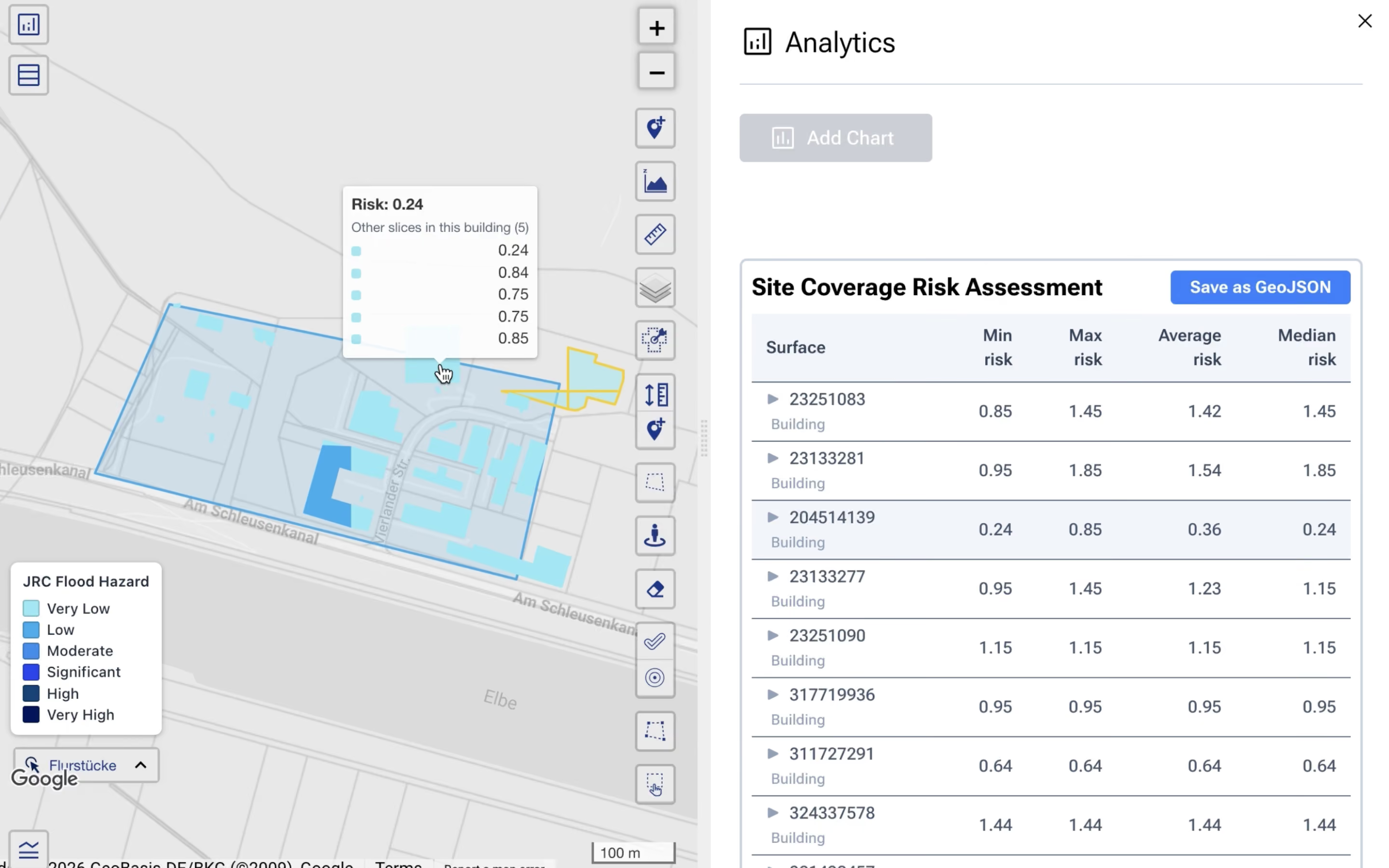
Overlay parcel boundaries, building footprints, and site geometries with hazard data to see where exposure occurs and which assets may be affected. This provides a more detailed spatial basis for property-level risk assessment.


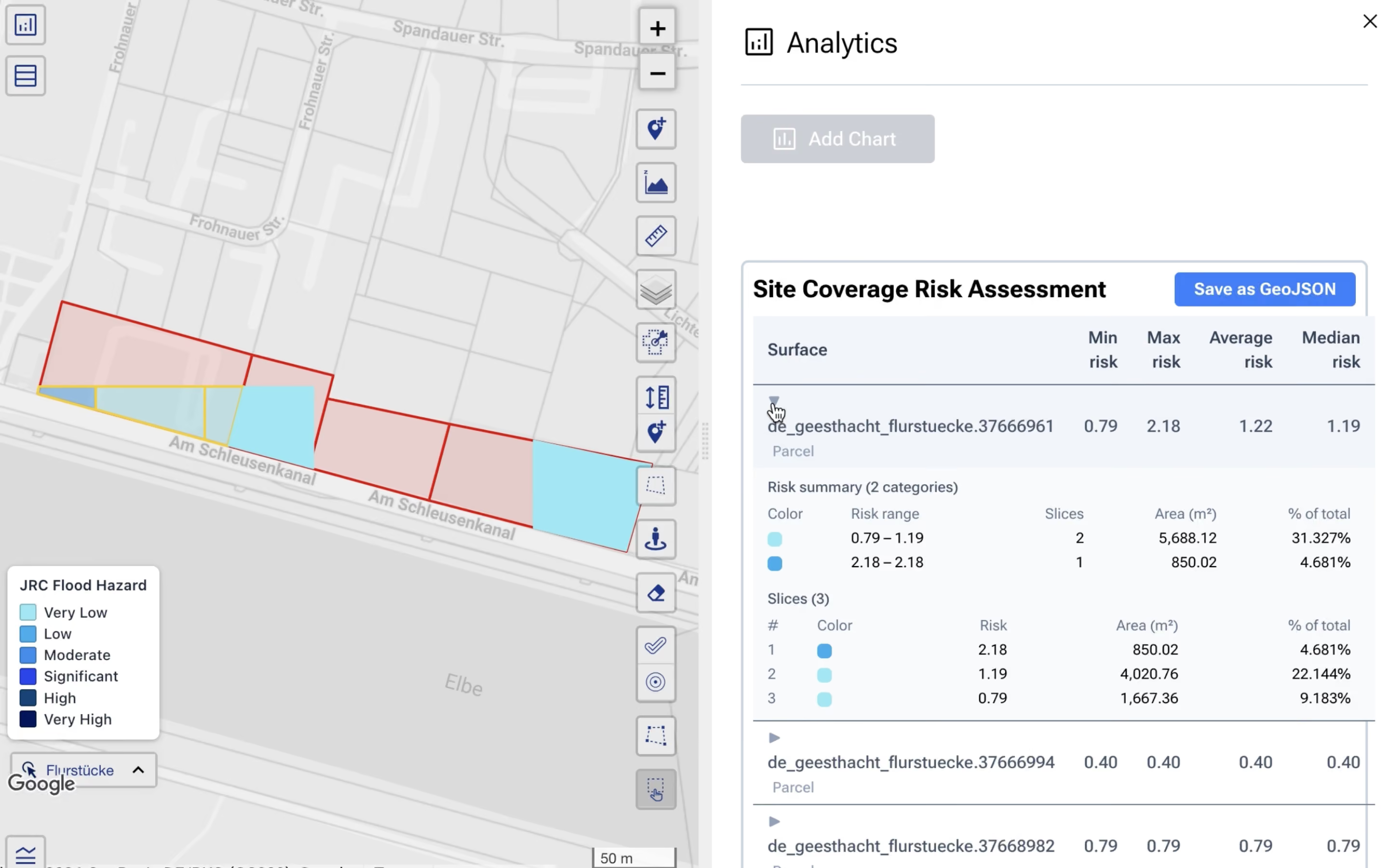
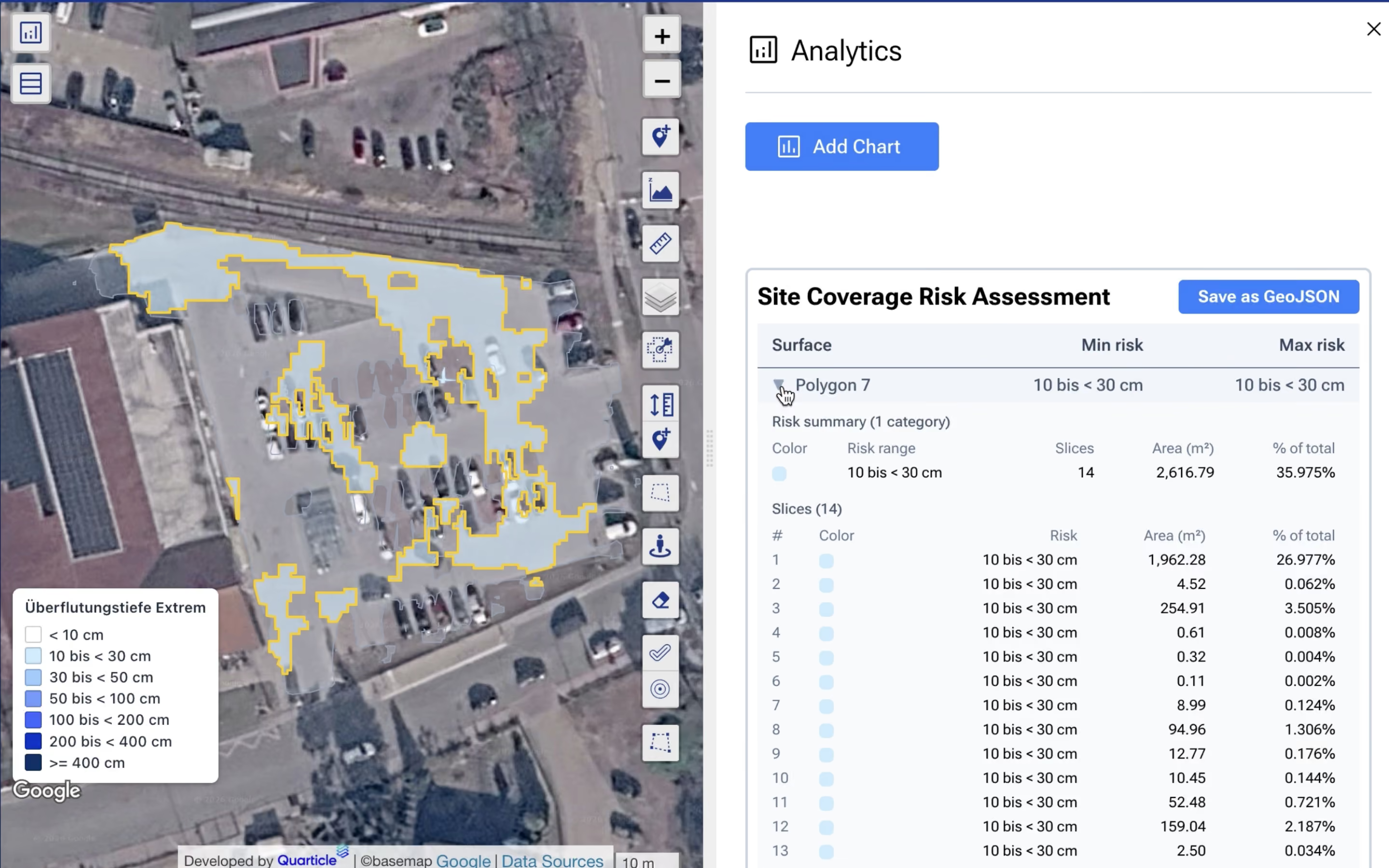
Measure how much of a property is affected and understand how exposure varies across different risk levels.
Analyse the area and percentage of a property exposed to each risk category. Where supported by the hazard data, review minimum, maximum, average, and median risk values or compare risk classes to distinguish between exposure profiles and identify areas that warrant closer investigation.
Apply the same assessment workflow to a single insured location, selected properties, or a larger defined area.
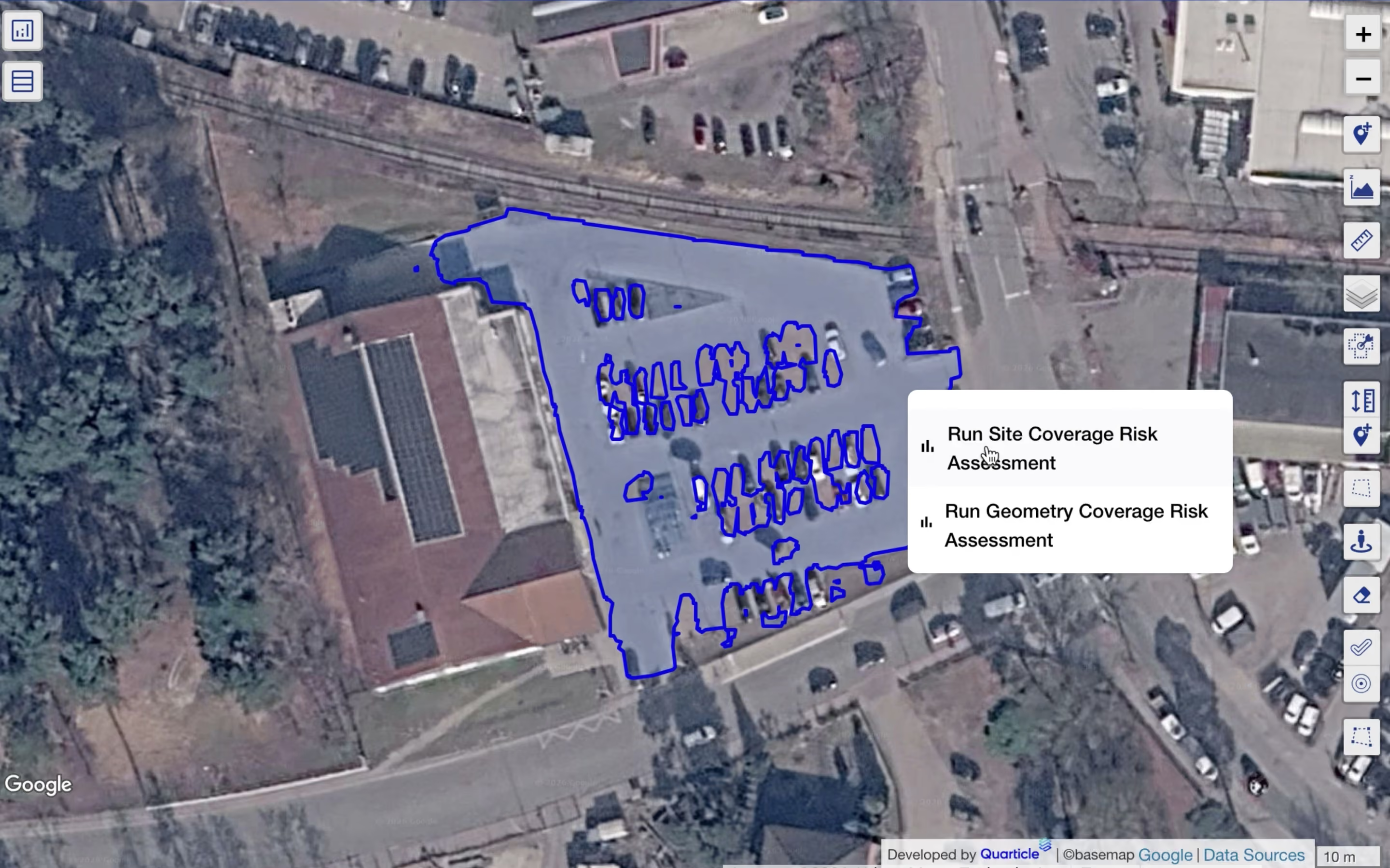
Define the assessment scope by selecting a point on a parcel, choosing multiple parcels, drawing an area on the map, or uploading property geometries in GeoJSON format. Assess individual buildings within the selected area or evaluate the selected geometry as a whole, depending on the needs of the analysis.


Move from an overview of property exposure to detailed spatial results that support further analysis.
Review mapped exposure alongside a summary table of results for each assessed parcel, building, or site. Examine individual assessed areas to understand their risk categories and affected areas, then export coverage results as GeoJSON to reopen them as a layer and incorporate them into subsequent geospatial workflows.
Property-level risk visibility through detailed insights into building and site exposure
Better-informed underwriting based on quantified hazard exposure
More targeted risk reviews focused on affected buildings and areas
More efficient analysis through reusable spatial assessment results
Quarticle combines geospatial processing, hazard intelligence, and spatial analytics to connect property data with the spatial context needed for insurance risk assessment.

Process property geometries and spatial datasets to support analysis across individual sites and multiple properties.

Bring natural hazard layers and available real-time event data into property assessment workflows to understand potential exposure to relevant hazards.

Explore property exposure on interactive maps, review assessment statistics, and export spatial results for further analysis.

Connect geospatial capabilities to existing systems through supported APIs and standard interfaces, with deployment options aligned with enterprise infrastructure and governance requirements.
Understand property-level hazard exposure to support risk selection and underwriting decisions.
Identify exposed buildings and site areas to prioritise inspections and mitigation reviews.
Compare exposure across insured properties to identify geographic concentrations of risk.
Use detailed spatial exposure results as an input to further exposure analysis and catastrophe modelling.
Identify properties intersected by hazard layers to help prioritise initial reviews and follow-up investigations.