
For other industries or use cases, contact us to discuss your requirements


The client is the largest primary insurance company in the world, with over 150,000 employees headquartered in Munich, Germany. As a global leader in insurance, reinsurance, and asset management, they needed a unified, cloud-based location intelligence platform to streamline underwriting, risk assessment, and portfolio analysis workflows.
The client relied on multiple fragmented GIS applications for risk assessment and portfolio analysis, creating critical inefficiencies:
They needed a fast, scalable, and compliant platform consolidating all GIS workflows into a modern, interactive underwriting experience.
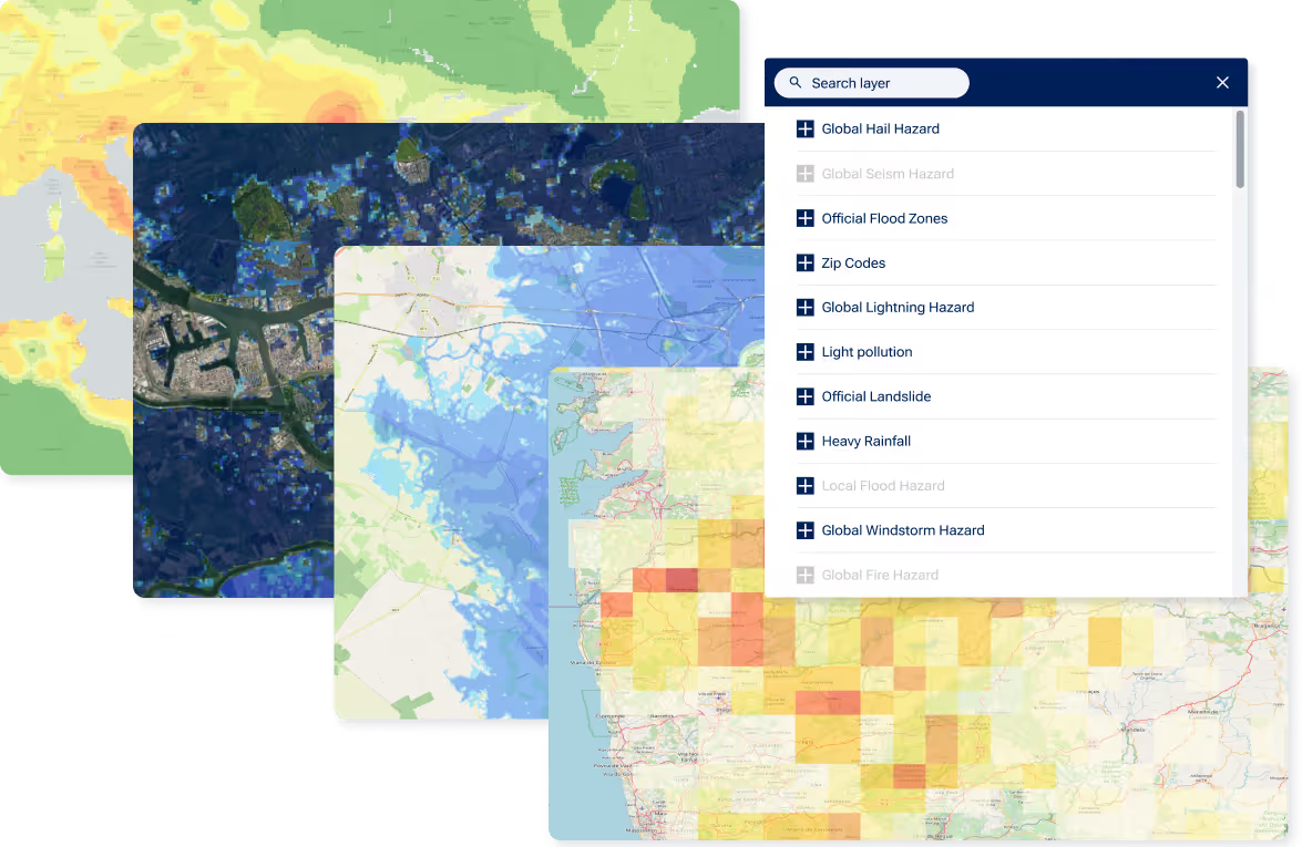
Integrated 6 GIS APIs, including geoenrichment, accumulation, and hazard layers
Modular architecture for seamless integration of existing and future APIs
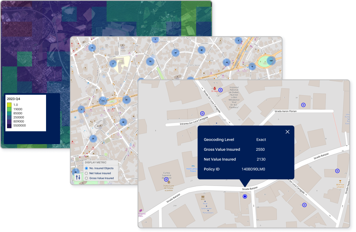
Interactive UI with point clustering, data symbolization, and layer querying
Optimized hazard layers for fast rendering and smooth panning across large datasets
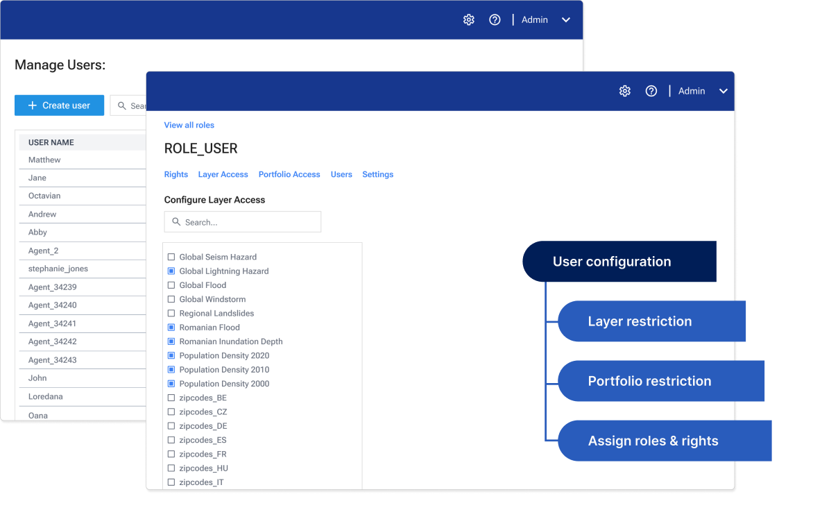
Multi-language support, configurable user restrictions, and admin management
Full VAIT/DORA compliance through advanced RBAC and privileged access controls
Unlimited user seats via our consumption-based pricing model, eliminating scaling costs
The solution enabled single-point risk assessment, portfolio visualization, and instant accumulation control directly at the point of underwriting, significantly improving operational efficiency.
Quarticle implemented a cloud-based, enterprise-grade location intelligence framework that replaced multiple legacy GIS applications, delivering real-time, interactive datasets with fast rendering. The platform streamlined underwriting workflows and improved the speed and accuracy of risk assessments.
Supporting unlimited users without incremental costs, the solution reduced operational expenses by 65% through a consumption-based pricing model. The Quarticle team met all objectives and deadlines, securing a long-term partnership with the client.
“Quarticle’s geospatial intelligence platform allowed us to harmonize our application landscape. Finally, we can centrally manage all geospatial workflows and drive efficiency and effectiveness across our underwriting workflows. Providing our customers and brokers with these significantly better and faster services not only saves operating costs, but also improves our underwriting decisions, and increases our margins – it allows us to provide the best-in-class experience to our users.”
Kai Ole Rogge, Former Head of GIS, Global P&C Insurer with 150,000+ Employees